It is just over 20 km, with a difference in height reaching almost 1,600 metres and an average gradient of 7.7%. A solid profile but nothing out of the ordinary. And yet.
And yet if you look north from the village of Bédoin, the view is blocked in front of his majesty the Ventoux. It is a bald, frightening massif, nineteen hundred metres of green which initially pales, then turns into a desert of stones, blue sky swept by endless wind. It commands respect, because you know it will win anyway, so you don't play around.
Unlike other mountains, which are always surrounded in turn by other mountains or hills, Mont Ventoux stands alone and unchallenged by a gentle soft plain, lush with vines and lavender. A peak that does not reach 2,000 metres but which has been made legendary by the great achievements and sporting dramas it has witnesses, culminating in the death of Tom Simpson on an exceptionally hot day in the thirteenth stage of the 1967 Tour de France due to a heart failure. Even Eddy Merckx, in 1970, felt unwell after the finish line.
It is a unique climb
To understand the difficulty of a climb, you often compare it with others of similar difficulty. But Mont Ventoux is unique. As you make your way up, you do not realise how steep it is because another distinguishing feature is that there are no hairpin bends, especially in the final part. The road is clear, wide, with a smooth surface, so time passes and you do not realise that you are actually climbing: you only see the observatory on the arid and distant summit that never seems to get any closer; simply take a look at the valley to realise the altitude reached and hope returns. The slope is not prohibitive. It is true that it never waivers, starting light from Bédoin, growing steeper after 6 kilometres, reaching peak gradients over 10% only in some stretches. But there is another element that plays against you as you make your way up, on Mont Ventoux one element never fails: the wind. And we all know, for cyclists, the wind is always against them.
Wind intensity often changes, and this has to be borne in mind: a gentle breeze at Bédoin can become a storm at the summit; wind speeds of 320 km/h have been recorded. And then there's the season. The best time to cycle up Mont Ventoux is May. It is true that the lavender fields explode with scents and colours in the warm summer months, generating an extraordinary landscape, but to tackle the climb it is best to avoid them, also because much of the route is completely exposed to the sun.
As for climbing times, an average trained amateur takes two and a half hours, as exceeding 10 km/h is difficult on this climb.
Three routes, the best from Bédoin
There are three routes that lead to the summit of Mont Ventoux: the best known, but also the most demanding owing to the last kilometres of the race exposed to the sun and gusts of wind, starts from Bédoin, which is why it is the centre for all cyclists who want to tackle the challenge; here, you will find sports shops, mechanics, rentals, and it is also well organised in terms of hospitality, including B&Bs and outdoor restaurants under the plane trees.
The route starts from rue du Mont Ventoux, the summit is about 22 kilometres away, but the start is completely restful, both because the slope is light and because it winds through vineyards and cypresses that act as a shield to the Mistral: the danger of the wind is still far away, but the menacing view of Mont Ventoux brings us back to reality and leads us to be cautious.
After 6 km you reach the Saint-Estève bend, which marks the beginning of the hardest part: the slope gradient increases significantly, from a mild 3% to 8-9% and even worse over 10%; a rapid change of pace and gear is required. And you need to take courage.
From the Saint-Estève bend to the Châlet Reynard
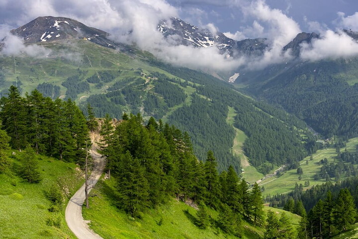
The regime of the climb changes, and so does the landscape: the route enters the Ventoux pine forest. The road follows the valley that descends from the mountain running mostly straight, with slight curves, and this immutability of conditions does not support the effort. You continue for another 10 kilometres to Châlet Reynard, the only refreshment point on the route; the slope decreases slightly, but the square is the prelude to the second most difficult section of the climb: 6 kilometres are left, initially with an average slope (6%), which turns to 8-10% in view of the pass.
Here you are immersed in the lunar landscape so familiar in the images of the summit: you are in full climb, with the scorching sun above and the wind against you. Anything else? Yes: fatigue and thin air, since you are at high altitudes, over 1,900 metres. This leads to the stone column in memory of Tom Simpson, adorned with flowers and water bottles, left by cyclists to pay their respects, out of affection and solidarity. It is worth a stop, to embrace the Englishman who, just two kilometres from the top of a mountain burned like the desert, gave his soul to cycling. Then you have to get back on track and push hard: the last effort, but the toughest one, is still to come.
When you get to the observatory, Mont Ventoux rewards you with a spectacular view in all directions, from its 1,909 metres of altitude. It is advisable to savour it and regain your strength for the descent: although you won't need to pedal any more, you still have to cover a 20-kilometre descent, so you'll still need your energy.


